China’s Cartographic Offensive on Three Fronts—and What It Means for India
India has tended to treat each episode as a bilateral matter, protest, and move on.
On April 10, 2026, China’s Ministry of Civil Affairs unveiled its sixth round of “standardised” place names for what it calls “southern Tibet”—a reference to India’s Arunachal Pradesh—adding 23 new entries to its expanding list. This latest exercise continues a pattern that began in 2017, taking the cumulative number of renamed locations to over 110.
Before 2017, such efforts were limited, with just 16 names officially retained between 2009 and 2017. However, the pace has accelerated significantly in recent years, with successive batches introduced in 2017 (6 names), 2021 (15), 2023 (11), 2024 (30), 2025 (27), and now 2026 (23), reflecting a sustained and deliberate push.
Notably, the 2026 list is overwhelmingly focused on geographical features rather than inhabited areas. Only two names—Chaku and Xinjing (Shincheon)—refer to settlements, both located in zones of historical or strategic relevance dating back to the Sino-Indian War. The remaining 21 names are assigned to mountains, peaks, and slopes, many situated around the Yarlung Tsangpo basin and its adjoining valleys, underscoring a targeted approach to cartographic assertion in sensitive terrain.
Three Fronts, One Target
Arunachal Pradesh is only one corner of a much larger game. In Nepal’s northern districts — Humla, Rasuwa, Sindhupalchowk — there have been documented encroachments over the last several years: border pillars moved, Chinese infrastructure appearing on areas Nepal’s own maps show as Nepali territory, grazing land that Himalayan communities have used for generations quietly absorbed into what Beijing treats as administered Chinese space. The renaming of these locations follows the encroachment, retrospectively assigning Chinese names to places already brought under de facto control.
Nepal’s response has been muted, for reasons that are not hard to understand. Its Belt and Road commitments — including the Pokhara International Airport, financed by Chinese loans and opened in 2023 — create financial obligations that generate strong incentives to avoid confrontation. Beijing’s United Front Work Department has invested heavily in cultivating relationships within Nepal’s major political parties and media institutions. And Nepal’s political instability — the country has cycled through governments with remarkable speed since its 2015 constitution — means there is rarely an administration in Kathmandu with both the institutional continuity and the political will to push back consistently.
In Bhutan, the stakes are starker still. China and Bhutan have been negotiating their border since 1984, with more than 25 rounds of talks without resolution. In 2020, China introduced an entirely new dispute by listing Bhutan’s Sakteng Wildlife Sanctuary as a “disputed area” at a Global Environment Facility board meeting, despite having raised no prior claim there. Sakteng lies in eastern Bhutan, far from the longstanding western disputes, abutting Arunachal Pradesh. The strategic logic was transparent: manufacture a new bargaining chip to trade for concessions in Doklam, the plateau whose military value China has coveted ever since the 73-day standoff of 2017.
Doklam matters not because of its size but because of where it points. A Chinese military presence there would command the Chumbi Valley, which in turn points directly at the Siliguri Corridor — the narrow strip of Indian territory, roughly 22 kilometres at its narrowest, that connects India’s entire northeastern region to the rest of the country. Strategists sometimes call it the Chicken’s Neck. It is the most consequential piece of geography on the eastern front, and it is what sits at the end of the thread that runs from Doklam through Bhutan’s border negotiations to Beijing’s renaming exercises in Arunachal.
The Real Prize Is Not on the List
None of the 23 newly named locations in Arunachal Pradesh are what China actually cares about most. Arunachal is a display case — a pressure point kept warm to ensure that India cannot concentrate its diplomatic and military energies on the one piece of territory that China genuinely cannot afford to lose: Aksai Chin.
China’s National Highway 219, which traverses the Aksai Chin plateau at an altitude, is the primary logistical link between Tibet and Xinjiang — two regions whose stability is central to the CCP’s territorial narrative. Beijing quietly built the road through Aksai Chin in the late 1950s before India even knew construction had begun. When New Delhi eventually discovered it, the resulting crisis fed directly into the 1962 war. India has never formally conceded the territory. Every official Indian map still shows Aksai Chin as part of Ladakh. The 2019 reorganisation of Jammu and Kashmir, which created the Union Territory of Ladakh with Aksai Chin explicitly within its stated boundaries, was a deliberate signal — and Beijing read it precisely that way. The military buildup in Ladakh that led to the Galwan Valley clashes of June 2020 was, at least in part, a response to Indian infrastructure development that China interpreted as preparatory to a more assertive posture.
The shadow of Zhou Enlai’s “package deal” offer to Nehru still haunts the diplomatic architecture. In 1959, China proposed recognising the McMahon Line in the east in exchange for India’s acceptance of Chinese sovereignty over Aksai Chin in the west. Nehru rejected it, and the offer was never formally revived. What China appears to be doing today is inflating the price of any future version of that deal: each new disputed name in Arunachal, each encroachment in Humla, each manufactured claim in Sakteng adds another chip to Beijing’s side of the eventual table. India’s domestic political constraints — no government can publicly concede Aksai Chin and survive — mean that formal negotiation remains frozen. But in the meantime, the ground shifts.
What India Has Got Right, and What It Hasn’t
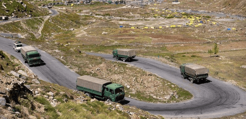
India’s response since Galwan has been more serious than its pre-2020 posture. The acceleration of border infrastructure in Ladakh and Arunachal — roads, tunnels, forward helipads — has been real and measurable. The forward deployment of additional mountain divisions has followed. The Modi government’s decision to ban hundreds of Chinese apps, restrict Chinese investment in sensitive sectors, and publicly call out Beijing’s encroachments represented a departure from the studied ambiguity that characterised Indian China policy for most of the 2000s.
What India has not done well is tell this story internationally. The cumulative pattern of China’s toponymic campaigns, its physical encroachments in Nepal, its manufactured Bhutan disputes, and its administrative restructuring in Xinjiang is not a series of bilateral irritants. It is a coherent grey-zone strategy whose logic would be recognised—and should concern—any government that has watched Beijing deploy the same playbook in the South China Sea.
India has tended to treat each episode as a bilateral matter, protest, and move on. It has not systematically built the international narrative that would make Beijing’s methods legible and costly in global opinion.
Disclaimer: Views expressed by writers in this section are their own and do not reflect Milli Chronicle’s point-of-view.